Use the following to search across all the cemeteries listed.
Example: "Smith, Roger" (yes, use the quotes)
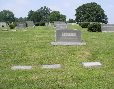
- 006 ANTIOCH BAPTIST CHURCH
 
Location - Dunns Mountain Road, Granite Quarry, a couple of blocks north of Hwy 52.
Coordinates: 35d 36m 59.0s N; 80d 26m 04.9s W Click here for Online Maps
- 007 CALVARY BAPTIST CHURCH
Location - 2255 E Ridge Rd. north of Salisbury about 4.5 miles and about 0.25 mile east of Old Mocksville Rd.
Coordinates: 35d 43m 27.0s N; 80d 27m 35.9s W Click here for Online Maps
- 001 LIBERTY UNITED METHODIST CHURCH
Location - south of Salisbury going out Stokes Ferry Rd (SR-1004) to 3640 Liberty Rd (SR-2140)
Coordinates: 35d 34m 41.3s N; 80d 20m 12.2s W Click here for Online Maps
- 009 MEMORIAL PARK CEMETERY
Location - at intersection of W Innes St and Grove St, Salisbury.
Coordinates: 35d 40m 42.9s N; 80d 28m 45.1s W Click here for Online Maps
- 005 ROCKWELL CEMETERY
Location - in Rockwell on Market St. at the intersection with Palmer Rd.
Coordinates: 35d 33m 18.2s N; 80d 24m 18.1s W Click here for Online Maps
- 008 ROWAN MEMORIAL PARK
Location - 4125 Franklin Community Center Rd, Salisbury.
Coordinates: 35d 43m 04.1s N; 80d 29m 44.2s W Click here for Online Maps
- 002 SALISBURY NATIONAL CEMETERY
Location - In Salisbury, NC off of Main St. and Military Avenue
Coordinates: 35d 39m 39.8s N; 80d 28m 28.4s W Click here for Online Maps
- 003 ST MATTHEWS LUTHERAN CHURCH
Location - 9275 Bringle Ferry Road, at the intersection with St. Matthews Church Rd.
Coordinates: 35d 36m 22.7s N; 80d 18m 02.8s W Click here for Online Maps
- 004 ZION UNITED METHODIST CHURCH
Location - 15055 Stokes Ferry Rd (SR-1004), Granite Quarry, NC, near the intersection with Reeves Island Rd (SR-2148)
Coordinates: 35d 31m 15.7s N; 80d 15m 25.3s W Click here for Online Maps
Web page updated 20 April 2021
|
|
 |